Notice: This Wiki is now read only and edits are no longer possible. Please see: https://gitlab.eclipse.org/eclipsefdn/helpdesk/-/wikis/Wiki-shutdown-plan for the plan.
EclipseLink/Examples/Radar
< EclipseLink | Examples
Contents
- 1 Application
- 1.1 Requirements
- 1.2 Analysis
- 1.3 Design Issues
- 1.3.1 DI1: Database: Derby or Oracle GIS/SDO aware?
- 1.3.2 DI2: Database Expected Volume
- 1.3.3 DI10: Determine color codes for Radar
- 1.3.4 DI11: Determine color codes for Satellite
- 1.3.5 DI12: Determine color codes for Lightning
- 1.3.6 DI21: Filter and Preprocess Radar Images
- 1.3.7 DI22: Filter and Preprocess Satellite Images
- 1.3.8 DI23: Filter and Preprocess Lightning Images
- 1.3.9 DI31: Contour or Convex Hull Extraction of storm events
- 1.3.10 DI51: Work around Historical Query Missing Data
- 1.4 WhiteBoard
- 1.5 References
Application
Requirements
R1: Determine layered GIS data for rainfall distribution at 1km resolution @ 200 km range
R2: Provide historical data
R2.1: Provide volumentric data per GPS position
R3: Provide 30 min prediction window
R3.1 Extend prediction window by including surrounding area weather
R4: Provide present status per GPS position
R10: Provide live consolidated view
R11: Provide query interface
Analysis
- The goal of this project is to provide a unified tracking view of current and future storm activity.
Design Issues
DI1: Database: Derby or Oracle GIS/SDO aware?
DI2: Database Expected Volume
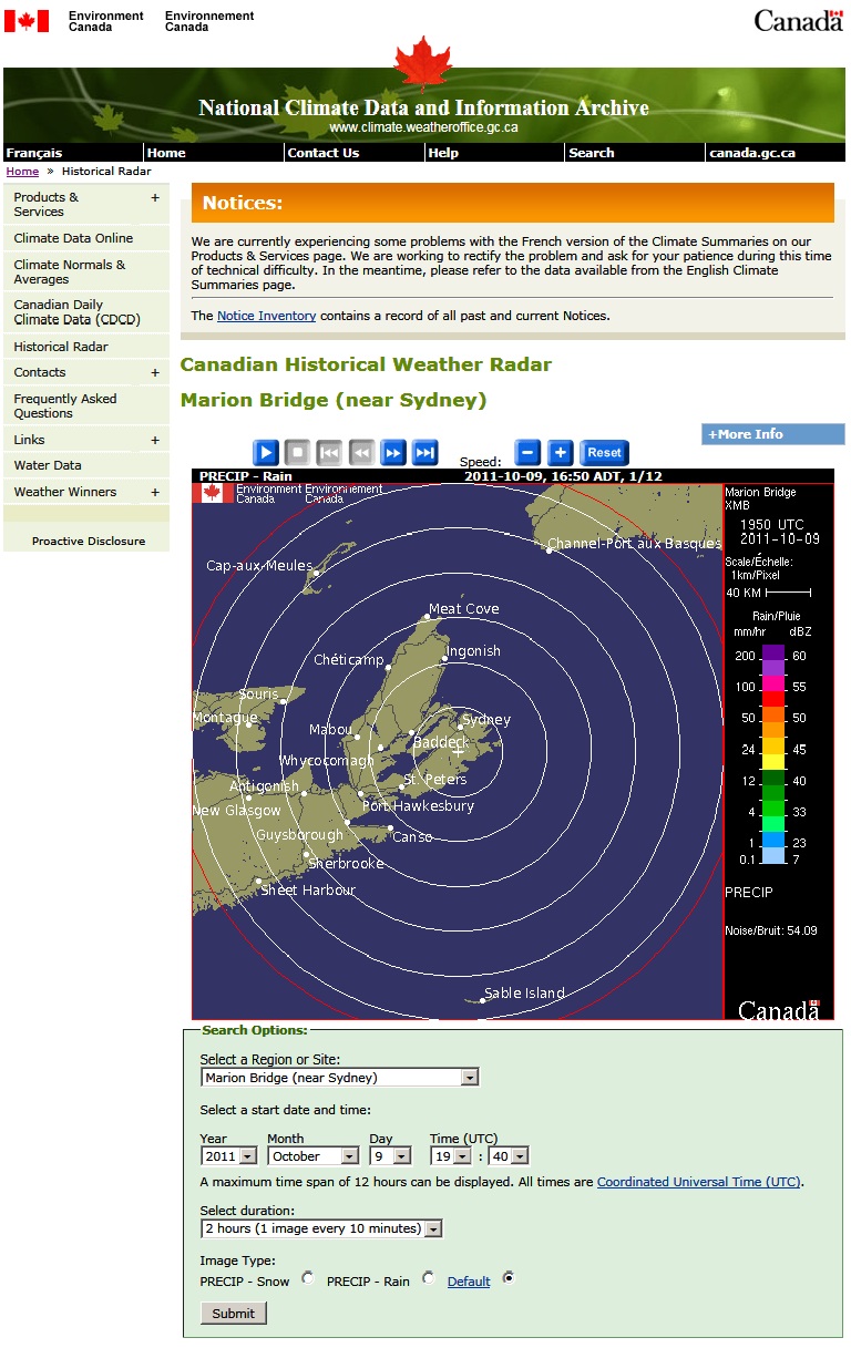
- There are 14 levels of rainfall represented by color bands from purple to light blue. If we include the ground color (green-grey), rivers (navy) and borders (black) we have 17 levels. We also want to encode (null/unset/no-data) as white or -1 - this gives us 18 levels which fits in a single 8 bit byte.
- There are approximately 500x480 pixels at 1km resolution which works to 234Kb decoded.
- We expect 24 x 6 = 144 images / site / day, which comes to 234Kb x 144 = 34Mb / day / site.
- We therefore need 12 Gb storage / year / site. A standard 2Tb drive which is around the effective limit of most databases will hold 169 years of data (disregarding compression gains and error handling losses). We should be able to hold our goal of 10 years of radar data for 16 sites comfortably.
- This assumes we store raw data without gps coordinates, we may want to only store colored pixels in data or gif format.
DI10: Determine color codes for Radar
DI11: Determine color codes for Satellite
DI12: Determine color codes for Lightning
DI21: Filter and Preprocess Radar Images
DI22: Filter and Preprocess Satellite Images
DI23: Filter and Preprocess Lightning Images
DI31: Contour or Convex Hull Extraction of storm events
DI51: Work around Historical Query Missing Data
- XMB_2011_10_09_19_40.GIF is actually 19:50 - some historical data may be off
- both queries give the same result (it looks like 19:40 is actually missing)
- http://www.climate.weatheroffice.gc.ca/radar/index_e.html?RadarSite=XMB&sYear=2011&sMonth=10&sDay=9&sHour=19&sMin=30&Duration=2&ImageType=Default
- Environment Canada returns you the next available result - but the query should return no data to be consistent.
WhiteBoard
- Add merged data/radar/temp_image/COMPOSITE_ONT/COMPOSITE_ONT_PRECIP_RAIN_2011_10_15_12_20.GIF
References
Radar Sites:
- http://en.wikipedia.org/wiki/Canadian_weather_radar_network
- http://en.wikipedia.org/wiki/Beckwith,_Ontario
- http://www.msc-smc.ec.gc.ca/projects/nrp/image_e.cfm?scale=true&s_image_querystring=city%3Dfranktown%26number%3D3&s_image_referrer=franktown%5Fe%2Ecfm&city=franktown&number=3
- http://radar.weather.gov/Conus/index_loop.php
Links
- http://en.wikipedia.org/wiki/Mesocyclone
- http://www.radar.mcgill.ca/who-we-are/history.html
- http://java.sun.com/javase/technologies/desktop/media/
- http://en.wikipedia.org/wiki/Numerical_weather_prediction
- http://en.wikipedia.org/wiki/Weather_radar

